SES Warn: Careful At Crossings
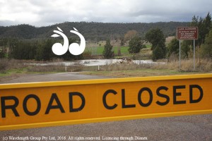
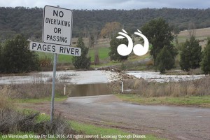
WITH the rise of local rivers and the closure of some crossings the local SES warns people not to drive, walk or ride through flood waters.
Mark Elsley, local controller at Muswellbrook SES monitors the local river systems and said they are expecting the rivers to rise with more rain predicted.
“We expect more water coming into the Pages and then the Hunter and we don’t know what other water might be coming down from gullies and creeks into the river systems,” said Mr Elsley.
“Because we’ve had rain and the rivers have been up it’s what we call charged; the aquifers are recharged and basically whatever falls on the land at the moment runs into the rivers and that’s what we get,” he said.
“Prior to this recent rain everything was dry and a fair bit of the water coming down the river system was soaked up into the river system itself that recharged the aquifers, the river banks and so forth what falls now will go into the streams,” Mark Elsley said.
People are warned not to use causeways if you can’t see the bottom and to take notice of height markers.
“If the water is coloured and you can’t see the bottom of the causeway, don’t go through it,” said Mr Elsley.
“The depth and the velocity of the water is problem and if there’s been rainfall and the crossing is up higher than normal don’t go through and if you’re not used to going through water, don’t go through,” he said.
“You don’t drive into a fire storm, so why drive through flood waters?
“If you go through and get washed off you are putting the lives of volunteers at risk, because we have to come in and try and rescue you,” he said.
He added that because of the buoyancy of 4WD’s they can lose traction and be washed away and insurance companies do not cover repairs if drivers have ignored closure signs.
“Water can affect the electrics of the vehicle and if the road is officially closed because of flooding and you go through I don’t know of any insurance company that would pay for the repair of the damage,” Mark Elsley said.
At 1pm today the Isis River at lower Timor was measured at 1.854 metres and 4,951 Megalitres a day (M/L/d).
At 1:30pm the reading at the Pages in Blandford was 3.338 metres and 8,703 M/L/d
The SES believes the rivers have peaked at lower Timor and Blandford, but more rain may cause them to rise again.
 scone.com.au
