William Nowland: 1804-1884
William Nowland was a farmer from Singleton, who discovered the pass over the Liverpool Range, north of Murrurundi, in 1827.
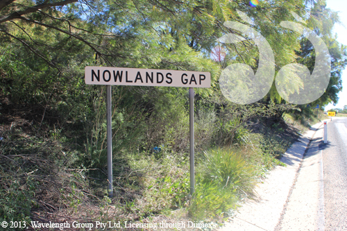
The pass discovered by William is still signposted as Nowlands Gap and the New England Highway still follows his route through the Hunter to the Liverpool Plains.

Nowland’s Gap, the pass over the Murrurundi Range to the Liverpool Plains.
Before William’s discovery explorers and early settlers were not able to take drays across the Range, which meant getting supplies to the Liverpool Plains was virtually impossible.
William Nowland wrote a letter to the editor of the Sydney Morning Herald in 1861, complaining of the treatment of squatters and land allocation in the early days of exploration and also recounts his discovery of the Pass:
“Singleton’s track over the main range was at the head of Dartbrook, and nearly impassable man or beast, it being so difficult to cross that the drovers have been so exhausted by endeavouring to drive cattle up the mountains, that they have had to rest themselves by holding a tree while they caught their breath. Many people went out to find a better road to cross the mountains with their stock, but all failed to do so. I was determined to find a better road if possible, and started from Liverpool Pains with my stockman, taking with me a pack-horse and rations. We travelled the mountains, endangering our lives with the blacks for the space of three months, and found at last the Gap in the main range, between Doughboy Hollow and the town now called Murrurundi. We then saw the valley of a river before us, now called the Page and Murrurundi. We went down to that river, and followed it for three miles, thinking it was one of the tributaries of the river Hunter, and seeing a large mountain on the south side, now called the Murlow Mountain, we ascended it to see if we could find any place to the southward of it that we knew, and fortunately saw a placed called the Downs, on Mr.Little’s farm, near Scone, and we could see the valley of Kindgon Ponds, up to the range now called Walden’s Range; we then descended it, and went to the range, after a few days we found a road to Kingdon Ponds. I marked the trees over the Liverpool and Walden ranges. We not only found better road for cattle, but one that a team could take two tons over the whole ranges, without one shilling expense to the Government. I then loaded a dray at Patrick’s Plains, and took up the first dray that ever went over the new road to Liverpool Plains. It being wet weather, the ground was soft, left a plain dray-track behind us from Kingdon Ponds to Liverpool Plains. When we arrived at the west side of the range we stopped and camped at a small creek, which I named Doughboy Hollow. I then proceeded to my station at Warrah.”1
The first settlers of the Scone township shifted from the small village of Redbank to establish a settlement along William’s track, including the St Aubin’s Arms and the Inn.
Nowland’s route became part of the Great North Road, the first road through the Hunter and over the Range into the Liverpool Plains; now known as the New England Highway.
William’s background
William was born at Castlehill, in September 1804; the sixth of nine children2 born to second fleet convicts, Michael Nowland and Elizabeth Richards.3
William and his siblings were among the earliest settlers in the Upper Hunter area, beginning with land grants in the Camberwell area, then known as Fallbrook.
Henry Nowland was a forefather of Muswellbrook, Edward Nowland was one of the earliest settlers on the Breeza Plains and Mary Nowland and her husband, Alexander Johnston, were early settlers in Scone.4
William and his brothers Henry, Michael and Edward all received land grants of 160 acres in the Singleton area.5
Camberwell
William was instrumental in the development of Camberwell, initially known as Falbrook. The village flourished until the 1860’s when a new bridge over Falbrook diverted traffic away from the village centre.6
William established the 1500 acre property “Rosedale” after buying a number of adjoining allotments7. He also purchased allotments in the village of Camberwell where he built shops, donated the Falbrook Public School building and built the Queen Victoria Hotel, which opened in 1841.8
Liverpool Plains
William was also one of the early explorers of the Liverpool Range.
He was co-occupier with Thomas Parnell and Philip Thorley of a property known as “Warrah”, which was unfairly9 taken by the AA Company in 1832.
“…he then established “Wallala” near Breeza and Wards Mistake, near Glen Innes. All his life he was troubled by corrupt Land Commissioners, cattle poachers, and dishonest neighbours.”10
In March 1836, William Nowland went down the Namoi and formed a station called Drildole (or Drilldool), which was the lowest on the Namoi at the time. He was much troubled by blacks, who attacked his men and stock. This station was occupied in 1866 by William Dangar.”11
William and his brothers were well known as farmers and early settlers; they also ran a carrying business. They transported passengers, goods and mail as far north as Queensland,12 no doubt helped by William’s discovery of Nowlands Gap over the Range.
Final resting place
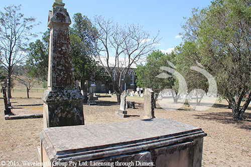
William Nowland died on April 28, 188413 aged 79 years and 7 months14. He is buried in St Clements church ground, Camberwell.

Grave of William Nowland, St Clement Anglican Church, Camberwell.
Footnotes:
- W.Nowland, ‘A Squatter’, To the Editor of the Herald, Sydney Morning Herald, January 23, 1861,p.3 [↩]
- L.Parkinson, email ‘Nowland Information’, February 19, 2013. [↩]
- William Nowland, Wikipedia http://en.wikipedia.org/wiki/William_Nowland, viewed February 19, 2013. [↩]
- L.Parkinson, ‘The Pioneering Nowland Brothers’, Hunter and Northwest Pages, Upperhunter.org, http://www.upperhunter.org/nowlandbros/index.html> viewed Feb 13, 2013. [↩]
- Heritas Architecture, Appendix 14, ‘European Heritage Assessment’, Ashton Coal Project Camberwell, NSW, p.19, 2009, cited on http://www.ashtoncoal.com.au/Resources/Reports–Publications/Environmental-Assessments/South-East-Open-Cut-EA/VOL5_Appendix_14_European_Heritage.pdf, viewed February 19, 2013. [↩]
- Heritas Architecture, Appendix 14, ‘European Heritage Assessment’, Ashton Coal Project Camberwell, NSW, p.12, 2009, cited on http://www.ashtoncoal.com.au/Resources/Reports–Publications/Environmental-Assessments/South-East-Open-Cut-EA/VOL5_Appendix_14_European_Heritage.pdf, viewed February 19, 2013. [↩]
- L.Parkinson, ‘The Pioneering Nowland Brothers’, Hunter and Northwest Pages, Upperhunter.org, http://www.upperhunter.org/nowlandbros/index.html> viewed Feb 13, 2013. [↩]
- L.Parkinson, ‘The Pioneering Nowland Brothers’, Hunter and Northwest Pages, Upperhunter.org, <http://www.upperhunter.org/nowlandbrod/index.html> viewed Feb 13, 2013, [↩]
- Royal Australian Historical Society Journal Vol 48, Pt5 Dec 1962, p.383. [↩]
- Heritas Architecture, Appendix 14, ‘European Heritage Assessment’, Ashton Coal Project Camberwell, NSW, p.19, 2009, cited on http://www.ashtoncoal.com.au/Resources/Reports–Publications/Environmental-Assessments/South-East-Open-Cut-EA/VOL5_Appendix_14_European_Heritage.pdf, viewed February 19, 2013. [↩]
- ‘William Nowland’, Wikipedia, http://en.wikipedia.org/wiki/William_Nowland, viewed December 16, 2013. [↩]
- Tombstone of William Nowland, St Clements Church graveyard, cited September 11, 2013. [↩]
 scone.com.au